Cove to Markets to Park
in the North End
(awaiting installation)

In the 1920s two wholesale markets covered the park site. Refrigerated rail cars brought meat into Clinton Market. Horse-drawn carts delivered produce to Mercantile Market. Fish shacks lined the waterfront.
Courtesy of Boston Public Library
Imagine being here over 100 years ago. You’d be on a busy city street with a freight line running down the middle and an elevated train line overhead. In front would be a bustling 35-acre market district distributing food locally and throughout New England.
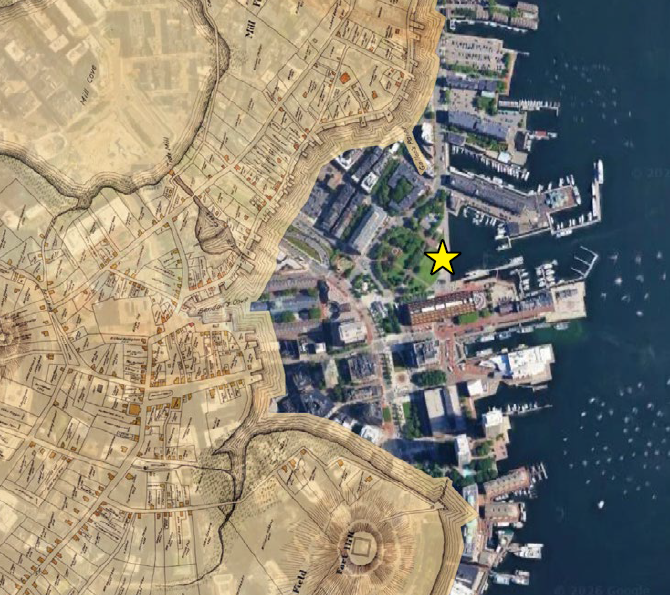
For centuries prior, this was the Great Cove. The shoreline was roughly along today’s North Street. Over time, landmaking projects moved the shoreline into the cove. By the mid-1800s it was at the Mercantile Wharf building. In 1870, the city built Atlantic Avenue across Great Cove to carry rail tracks connecting train depots to the north and south. They filled the cove, creating land for an expanded market district adjacent to Quincy Market.
By the 1960s, narrow streets and outmoded facilities curbed market activity. The city developed a plan to create a waterfront park with input from the North End/Waterfront community. The markets were relocated and Atlantic Ave rerouted away from the water’s edge. Today the Friends of Christopher Columbus Park work to enhance the beloved park for all to enjoy.
This overlay of the contemporary city with a 1648 Boston map shows how the Great Cove once stretched from Lewis Wharf to Rowes Wharf.
Courtesy of Mapjunction
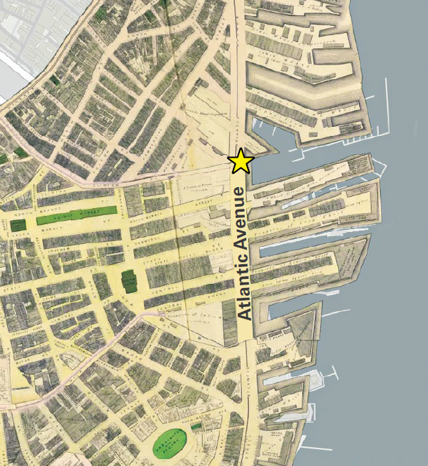
The newly built Atlantic Ave sliced through the great wharves of Boston from India Wharf to Lewis Wharf. Dirt from leveling the former Fort Hill (here Washington Square) was used to fill the former cove.
1874 Hopkins map courtesy of Mapjunction
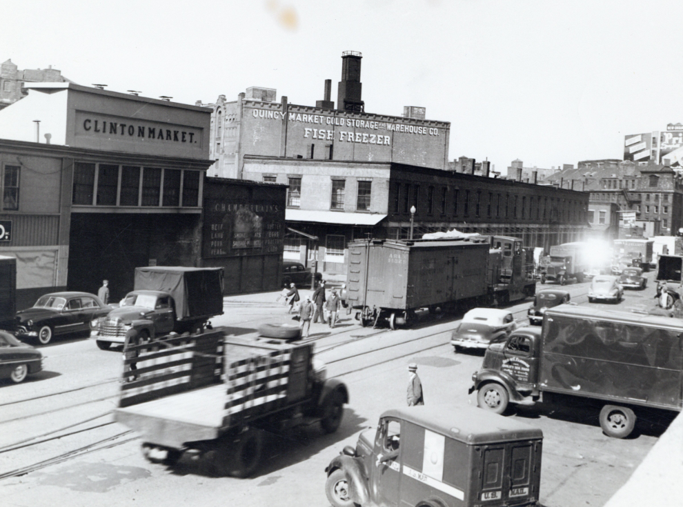
A freight car sits on tracks at this very spot, near a rail spur leading into Clinton Market. Additional spurs led to North End wharves.
1948 photo Courtesy of City of Boston Archives
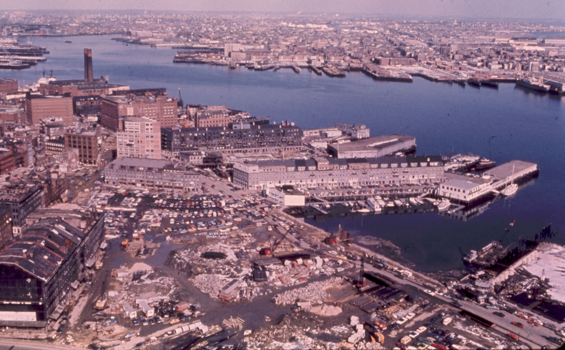
During the final days of the old Atlantic Ave, cars sped past a large construction site. Within two years the road had become a promenade that is now part of the Boston Harborwalk and the site a 4.5-acre park hailed as the capstone of Boston’s waterfront revitalization.
1974 photo Courtesy of Boston Public Library
Sign Location

More …
Resources
- Del Giudice, Margurite. “Boston opens ‘link to sea.’” The Boston Globe, May 10, 1976.
- Giovannini, Joseph. “Boston Waterfront at 25: A Model Urban Renewal.” The New York Times, September 21, 1986.
- “Redevelopment of the Boston Waterfront, Draft.” Kennedy School of Government, 1976.
- Seasholes, Nancy S. Gaining Ground: A History of Landmaking in Boston. Massachusetts Institute of Technology 2003.
- Smith, David I. “19th Century Development of Refrigeration in The American Meat Packing Industry.” Tenor of Our Times, Vol. 8 Article 14.
- “The Wholesale Markets at Boston, MA.” U.S. Department of Agriculture, Production and Marketing Administration, June 1950.
- Yudis, Anthony J. “Blight gives way to Christian Park on the waterfront.” The Boston Globe, May 2, 1976.
- Yudis, Anthony J. “Lots and Blocks.” The Boston Globe, September 29, 1974.
Acknowledgments
- Our gratitude to the Perkins School for the Blind Recording Studio and Thomasine Berg for their partnership in creating the audio files.