航水道的改變
in South Boston

在1929 年,運糖船 SS Evelyn 被拖過國會街大橋時導致交通一道受阻。 其後,吊橋取代了圖片中的擺跨橋。 新的吊橋廢除了擺跨橋的中心鼓,為航水道增加了75 英尺。
由波士頓公共圖書館 Leslie Jones 收藏提供
Fort Point Channel (尖角堡航水道)最初是一條天然的深水道。在 19 世紀,因兩岸新填成的土地而得到更明確的定位。它多年來都是一條繁榮的工業水道,直至 20 世紀才漸漸衰落。
各種工業廠在兩岸新填成的土地建業,包括鑄鐵廠、製糖廠和機械廠在一側,皮革工業廠在另一側。航水道上擠滿了載著木材、磚塊和水泥等材料的船隻,運往發展蓬勃的工業和住宅區。
糖和糖蜜被運到這裡一帶的倉庫。煤炭並透過船隻和火車運送到工廠和及後發電廠來作為蒸汽機和機械燃料。
跨過航水道的吊橋改善了進入南波士頓工業區的交通,但減慢了船隻運送的速度。新建的鐵路、沿岸的新碼頭及南灣的填海工程並減少了航水道的需要。在 1950 年代,當橋樑正式被固定後,航水道上的船務便結束了。現在,兩岸上的新發展並慢慢複興了這條歷史悠久的水道為休閒和文化目的地。
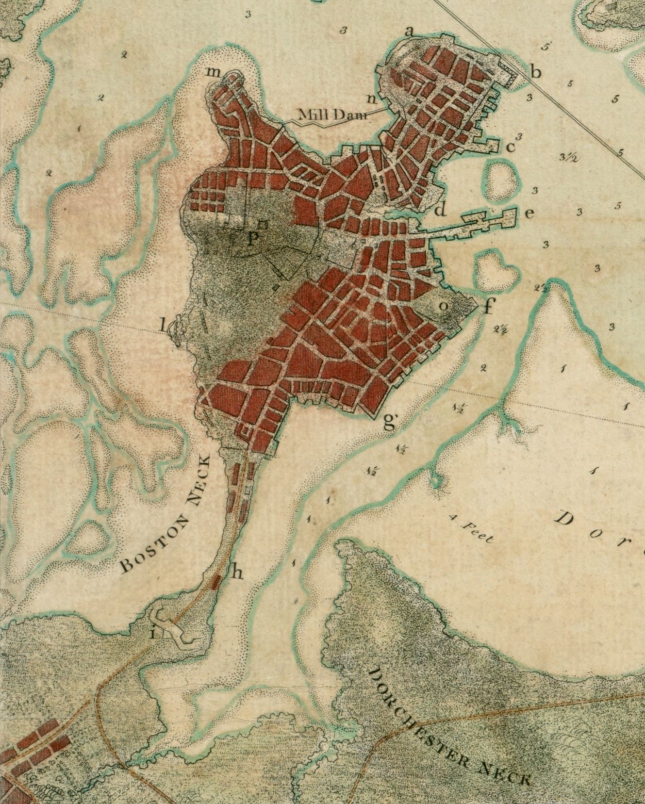
此圖為 1775 年的波士頓港,圖中可見波士頓半島和泥灘之間的天然深水道。 該水道位於 Fort Hill (山堡 )的底部,並稱為 Fort Point (f) (尖角堡)。
由波士頓公共圖書館 Norman B. Leventhal 地圖和教育中心提供
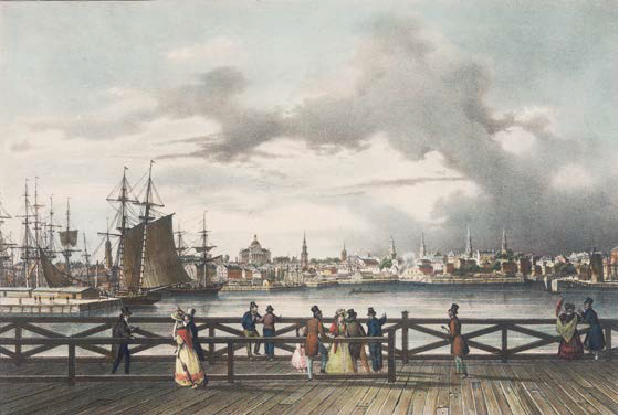
在1820 年代,重工業還未盛行前 ,很多富貴的波士頓人喜歡在南波士頓橋上漫步。 這座橋位於南灣和北面尖角堡航水道的中間。 現在,這位置為 West 4th Street (西四街),可見航水道於涵洞終止。
由波士頓雅典娜神廟提供
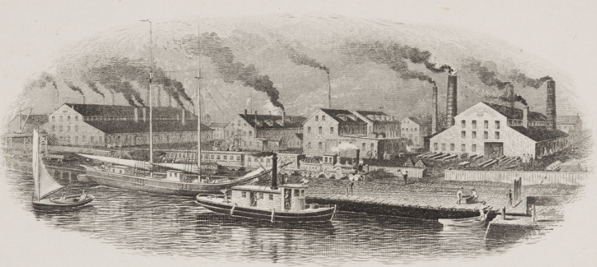
船隻和火車把鐵礦和煤炭運到像 Cyrus Alger 位於南波士頓鋼鐵廠等的工業。 煤炭並是熔鐵爐的燃料。
由紐英倫歷史機構提供
在1903 年,航水道仍然充滿船隻。 有些船隻並穿過橋樑,一直航行到右上角的南灣。
由國會圖書庫提供
標牌位置

更多 …
資料搜集(英文)
- Bennett, Lola. Historic American Engineering Record: Summer Street Bridge: HAER NO. MA-135. National Park Service, 1995.
- Carolan, Jane. Historic American Engineering Record: Fort Point Channel: HAER NO. MA-130. National Park Service, 1995.
- Clement, Dan and Peter Stott. Historic American Engineering Record: Congress Street Bascule Bridge: HAER NO. MA-38. National Park Service, 1984.
- Clement, Dan and Peter Stott. Historic American Engineering Record: New York, New Haven and Hartford Railroad Fort Point Channel Rolling Lift Bridge: HAER NO. MA-35. National Park Service, 1984.
- “Fort Point Channel Activation Plan.” City of Boston, 2002.
- The Fort Point Channel Landmark District: Boston Landmarks Commission Study Report. City of Boston, 2009.
- Hollinger, Steve. Boston’s Fort Point District: A Landmark of New England’s Maritime and Industrial Past. Boston Landmark Commission, 2001.
- Leather District: National Registration of Historic Places Inventory Nomination Form. U.S. Department of Interior Heritage Conservation and Recreation Service, 1980. Massachusetts Historical Commission Reconnaissance Survey Town Report Boston, 1981.
- Seasholes, Nancy S. Gaining Ground: A History of Landmaking in Boston. The MIT Press, 2003.
- Stott, Peter. “Economic and Industrial Development.” Historical and Archaeological Resources of the Boston Area: A Framework for Preservation Decisions. Massachusetts Historical Commission, 1982.
- Stott, Peter. A Guide to the Industrial Archaeology of Boston Proper. The MIT Press, 1984.
- Stott, Peter, South Boston. Draft industrial archeology report on firms in South Boston, On file at Massachusetts Historical Commission.
- Tyrrell, Michael J. Boston’s Fort Point District. Arcadia Publishing, 2003.
致謝
- 在此衷心感謝 Nancy Seasholes 為我們提供的幫助。
- 特別感謝 Peter Stott 與我們分享未刊登的論文和回答我們對他過去已完成的工作的提問。謝謝你的慷慨、耐性和包容。