Prestigious Wharf and Building
in the Wharf District
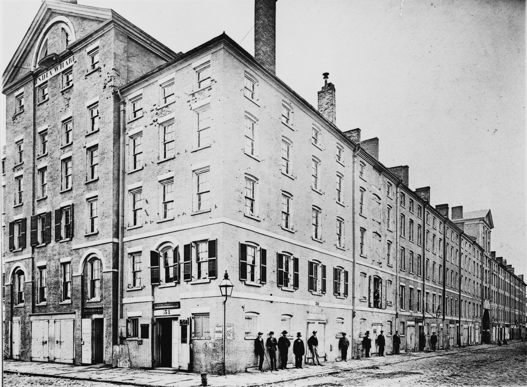
The Bulfinch building’s prominent façade faced the harbor, to impress incoming vessels. The first floor had retail businesses, from sailmakers and coopers to barbers and grocers. The top floors provided warehouse space. The photo was taken before 1868.
Photo courtesy of Library of Congress
As global sea trade opportunities expanded, a group of Boston investors proposed a new deep-water wharf, along with new streets and buildings. They hired architect Charles Bulfinch to draw the plans, creating Broad and India streets. Construction of India Wharf began in 1804, and soon after, Bulfinch designed the India Building that stood here for more than 150 years.
To have one’s office at India Wharf was considered highly prestigious. Boston’s leading ship owners had their “counting houses” on the second floor, while the ground floor was filled with sea trade-related retail businesses. The building also housed the consulates of Belgium, Russia, Norway, and Sweden.
In the 1860s, shipping to this area of Boston Harbor began to decline, largely because there was no rail access to move goods inland. A new sea wall was constructed in 1869 and fill added between the wharves, shortening Central and India wharves. A century later, the last section of the once prominent Bulfinch building was torn down.
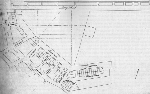
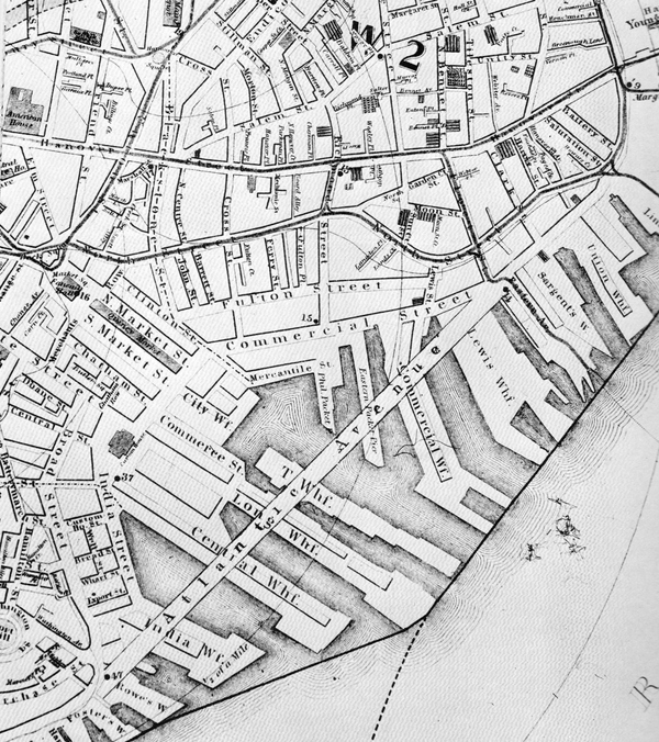
The 1810 plan shows new streets, buildings, and India Wharf as well as plans for Central Wharf to be built between India and Long wharves.
Original plan from Historic New England. Illustration with added text by Mary Reilly in Gaining Ground: A History of Landmaking in Boston. Courtesy of author Nancy S. Seasholes
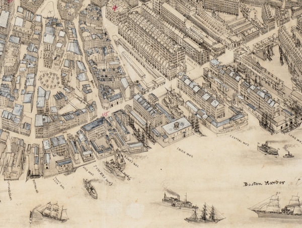
In this detail of the 1879 O.H. Bailey bird’s-eye view of Boston, the new Atlantic Avenue reduces the length of Central and India wharves, severing their buildings in half.
Courtesy of the Norman B. Leventhal Map and Education Center at the Boston Public Library
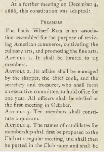
In 1886, a group of prominent Boston men established the India Wharf Rats club on the third floor of what remained of the India Building. They met twice a month for dinner and poker. When the building came down in 1962, the club moved to the Custom House Block on Long Wharf.
Courtesy of Historic New England
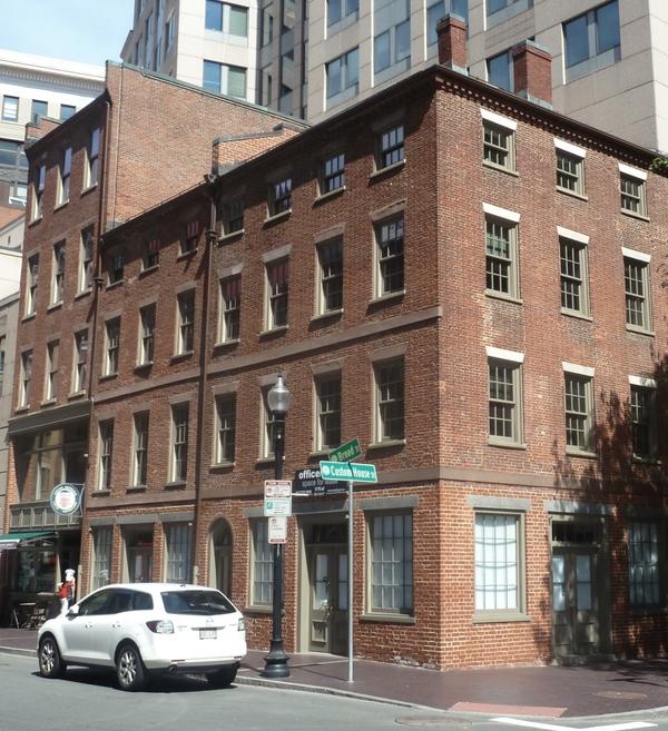
Number 68 is one of several buildings on Broad Street dating back to 1802.
Sign Location

More …
To see how the original wharf and India Building compare to today’s India Wharf and location of the two towers, visit www.mapjunction.com and overlay an early 19th century map onto a present-day map.
The plan showing how the new Atlantic Avenue would dramatically shorten Boston’s downtown wharves.
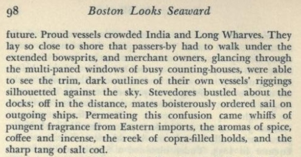
Excerpt from Boston Looks Seaward
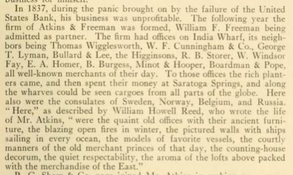
Excerpt from Some Merchants and Sea Captains of Old Boston, published by State Street Trust Company, 1919.
New members could join if proposed by current member, but two negative votes were sufficient to have one’s application rejected.
Community activists. Colonial law. Political will. New state regulations. The combination created the 43-mile Boston Harborwalk–a public path, stretching from Logan Airport through seven neighborhoods to the Neponset River. In 1978, the Massachusetts Office of Coastal Zone Management (CZM) sought to improve public access to the waterfront. They succeeded by integrating early Colonial laws into new state regulations.
In the decades that followed, community activists, city and state government, and developers of shoreline projects have worked together to ensure the Harborwalk is always constructed along the waterfront. Some sites also provide public amenities–bathrooms, meeting places, kayak launches, etc. The result is a fabulous path welcoming residents and visitors to our vibrant clean harbor.
Early Colonial laws established public right of access along tidelands to protect citizens’ rights to fish, hunt, and navigate at sea and along the shorefront. These laws go back even further: They stem from Roman law, which was incorporated into English law and brought over to Massachusetts by English settlers. Then, in the 1640s, Massachusetts Bay Colony passed laws permitting private docks in the intertidal area (between low and high tide) as long as public access was retained. Almost all of Boston’s waterfront is filled land that was once the intertidal area. This, together with the centuries-old legal right of access, served as the underpinnings for the 1978 CZM regulations.
Resources
- Bunting, W. H. Portrait of a Port, Boston 1852-1914. The Belknap Press of Harvard University Press, 1971.
- Bunting, W. H. The Camera’s Coast: Historic Images of Ship and Shore of New England. Historic New England, 2006.
- Garrison, J. Ritchie. Two Carpenters: Architecture and Building in Early New England, 1799—1859. University of Tennessee Press, 2006.
- Seasholes, Nancy. Gaining Ground: A History of Landmaking in Boston, The MIT Press, 2003.
- Col Frank Forbes: “The Old Wharves of Boston” Proceedings of the Bostonian Society, Jan 15, 1952.
- Rossiter, William Sidney, Ed. Day and Ways in Old Boston. “The Old Boston Water Front,” Frank H. Forbes, R. H. Stearns & Co., 1915.
- Vrabel, Jim. When in Boston: A Timeline and Almanac. Northeastern University Press, 2004.
- Wheelwright, John T. “A History of the India Wharf Rats, 1886-1911.” Merrymount Press, 1912.
- Whitehill, Walter Muir. Boston: A Topograhical History. Belknap Press, Harvard University Press, 2nd Ed 1968.