Local Industries
in East Boston
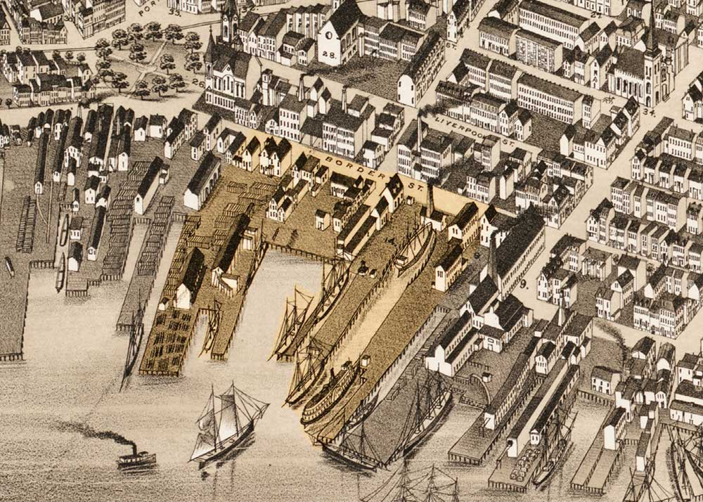
Small buildings housed the many businesses operating here, and stacks of lumber lined the wharves (Border Street between Central Square and Maverick Street).
O.H. Bailey & Co., 1879, map reproduction courtesy of the Norman B. Leventhal Map Center at the Boston Public Library
Many businesses operated on this site, including a steam sawmill, a blacksmith and tin shop, several lumber yards and coal companies, and a carriage factory. They contributed to a thriving corridor of shipbuilding and related industries on this waterfront, which lasted into the 20th century.
These industrial uses date to the earliest days of East Boston development when the East Boston Timber Company was established in 1834 with an eye to encouraging shipbuilding. Timber was shipped from upstate New York, via the Erie Canal, and stored under water at a timber dock built here. The company went bankrupt six years later, but the large supply of inexpensive timber left behind did spur local shipbuilding. East Boston’s first shipbuilder, Samuel Hall, purchased a portion of the property.
In later years, other lumber companies were among the businesses that occupied this site, including George McQuesten & Company. McQuesten dealt primarily in southern hard pine–used extensively in local construction –and likely contributed to a cluster of home building businesses across the street.
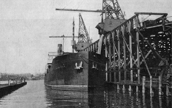
West Virginia coal was unloaded at the Burton-Furber Coal Company, which operated here into the mid 20th century. The coal fueled sea-going vessels, East Boston’s North and South ferries, and institutions such as MIT.
Courtesy of Coal Age
William H. Sumner, writing of East Boston in 1858:
“[Before 1833], oyster-beds lined its shores; now, millions in value, comprising more than half the commerce of Boston, unload at its spacious wharves.”
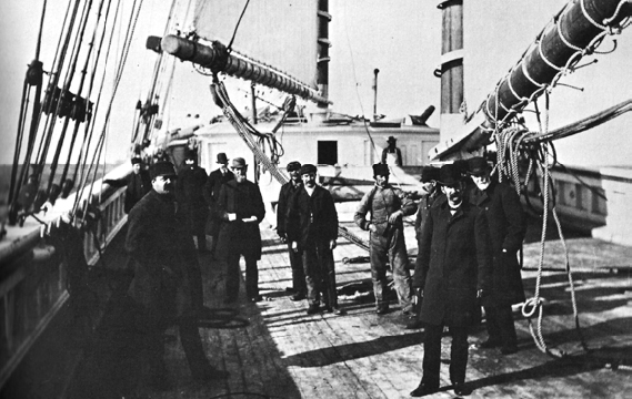
George McQuesten (far right) transported lumber from Florida and Georgia to this site on his own schooners.
Sign Location

More …
Resources
- The Boston Directory. No. LXXVII. Boston: Sampson, Davenport, and Company, 1881.
- Boston Redevelopment Authority. Amendment to the East Boston Waterfront District Municipal Harbor Plan – 6-26 New Street, Boston East, 125 Sumner Street. Boston: City of Boston, 2008.
- City Record, Vol 10. Boston, MA: Superintendent of Printing, 1918.
- Bunting, W.H. Portrait of a Port: Boston, 1852-1914. Cambridge, MA: Belknap Press, Harvard University Press, 1971.
- Fort Point Associates. Boston East Draft Environmental Impact Report, Draft Project Impact Report, Volume 1 of 2. Boston: Boston Redevelopment Authority, 2008.
- Fort Point Associates. Boston East Project Notification Form, Environmental Notification Form. Boston: Boston Redevelopment Authority, 2007.
- Massachusetts Historical Commission. Inventory Form East Boston Dry Dock Company / Atlantic Works, 2008.
- Massachusetts Historical Commission. Inventory Form East Boston Inner Harbor Industrial Area, 1997.
- The Public Archaeology Laboratory, Inc. Technical Report, Intensive (Locational) Archaeological Survey, 122-148 Border Street Development. Rhode Island, 2015.
- Seasholes, Nancy & The Cecil Group. Sites for Historical Interpretation on East Boston’s Waterfronts. Boston: Boston Redevelopment Authority, 2009.
- Sumner, William H. History of East Boston: With Biographical Sketches of its Early Proprietors, and an Appendix. Boston: William H. Piper and Company, 1858.
- War Department Corps of Engineers, U.S. Army and United States Shipping Board. Port Series No. 2: The Port of Boston. Washington: Government Printing Office, 1922.
- Wolkins, G. G. “Trade Conditions in New England in 1918”, Coal Age Vol 15 No. 3, 1919.
Acknowledgments
- Translation and recording thanks to the generosity of the Boston Marine Society
- Our gratitude to the Perkins School for the Blind and David W. Cook for their partnership in creating the audio files