Crossing the Harbor

in East Boston

Noddle Island steaming toward East Boston, 1911

Courtesy of Historic New England

For 118 years, ferries connected East Boston to Boston’s downtown waterfront. In fact, the first vessel built here was a ferry, the East Boston, launched in 1834. At one time three separate routes were operating—an essential part of East Boston life.

“My grandfather used to collect fares for the ferry ride, one cent for a person, free on July 4th,” recalled one resident. “A horse and team cost five cents. The ferries were always packed with passengers, horses and teams, an occasional model T, and pushcarts.”

In 1904, a streetcar tunnel under the harbor—now the Blue Line—opened. It was the first underwater subway in the U.S. It was not for everyone, however. “My mother was terrified of going through the tunnel,” an East Boston teacher remembered. “She always took the ferry and sat in the companionway so her hat would not blow off.” When the Sumner Tunnel opened in 1934, the ferry’s years were numbered. The last East Boston ferry crossed in 1952.

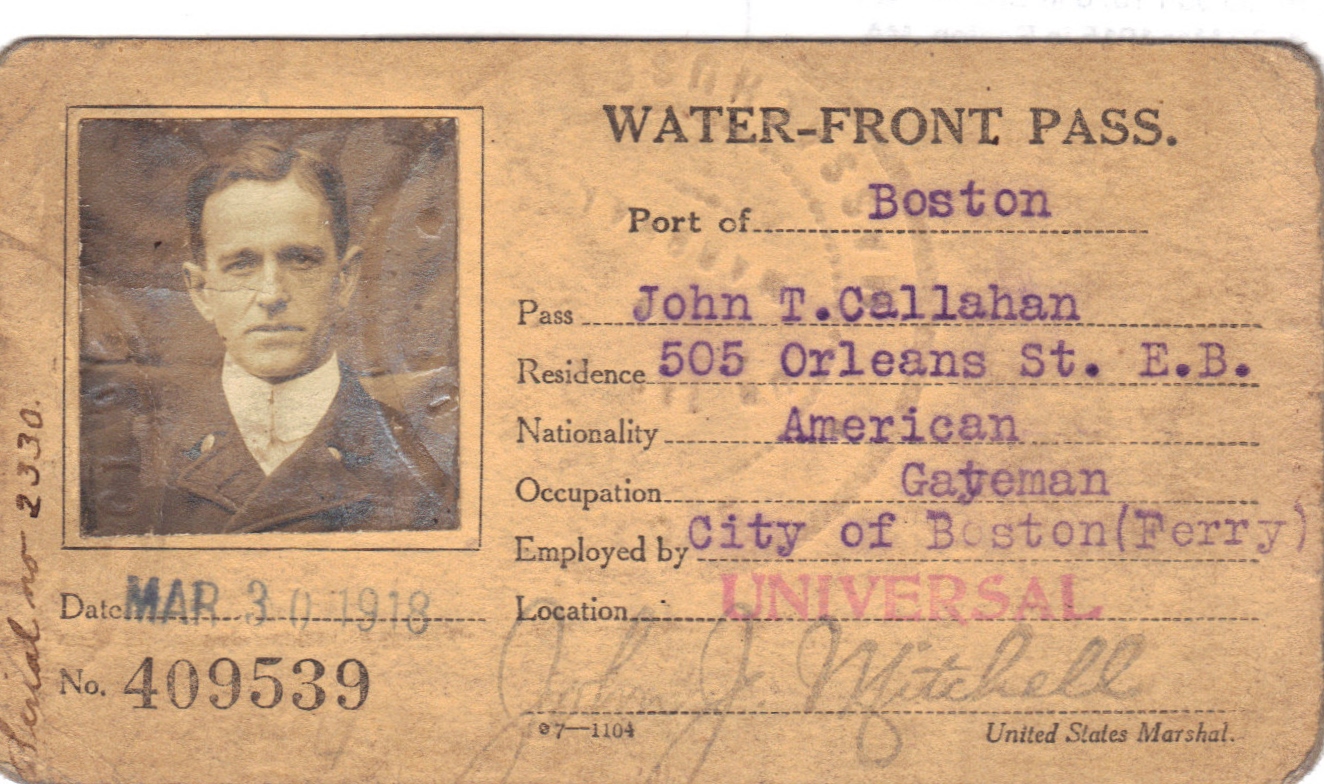
An identification card issued to South Ferry fare collector John T. Callahan during World War I when access to the East Boston waterfront was restricted.

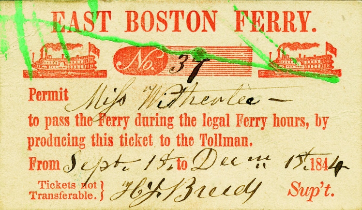
East Boston Ferry ticket courtesy of Historic New England

As a youngster, I sold newspapers on the Lewis Street Ferry. I always enjoyed being up front and watching the pilot throw the ship’s props into reverse which would churn up a tremendous wake and then the ferry would slam into these huge telephone-pole-type timbers and slide into the dock.”  (Mario Carco, Melrose Mirror, November 1999)

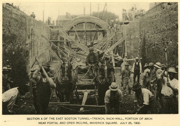
Two teams digging the Blue Line tunnel simultaneously from each side met beneath the harbor on July 4, 1903, and the first streetcar ran through six months later.

Courtesy of the Boston Athenaeum

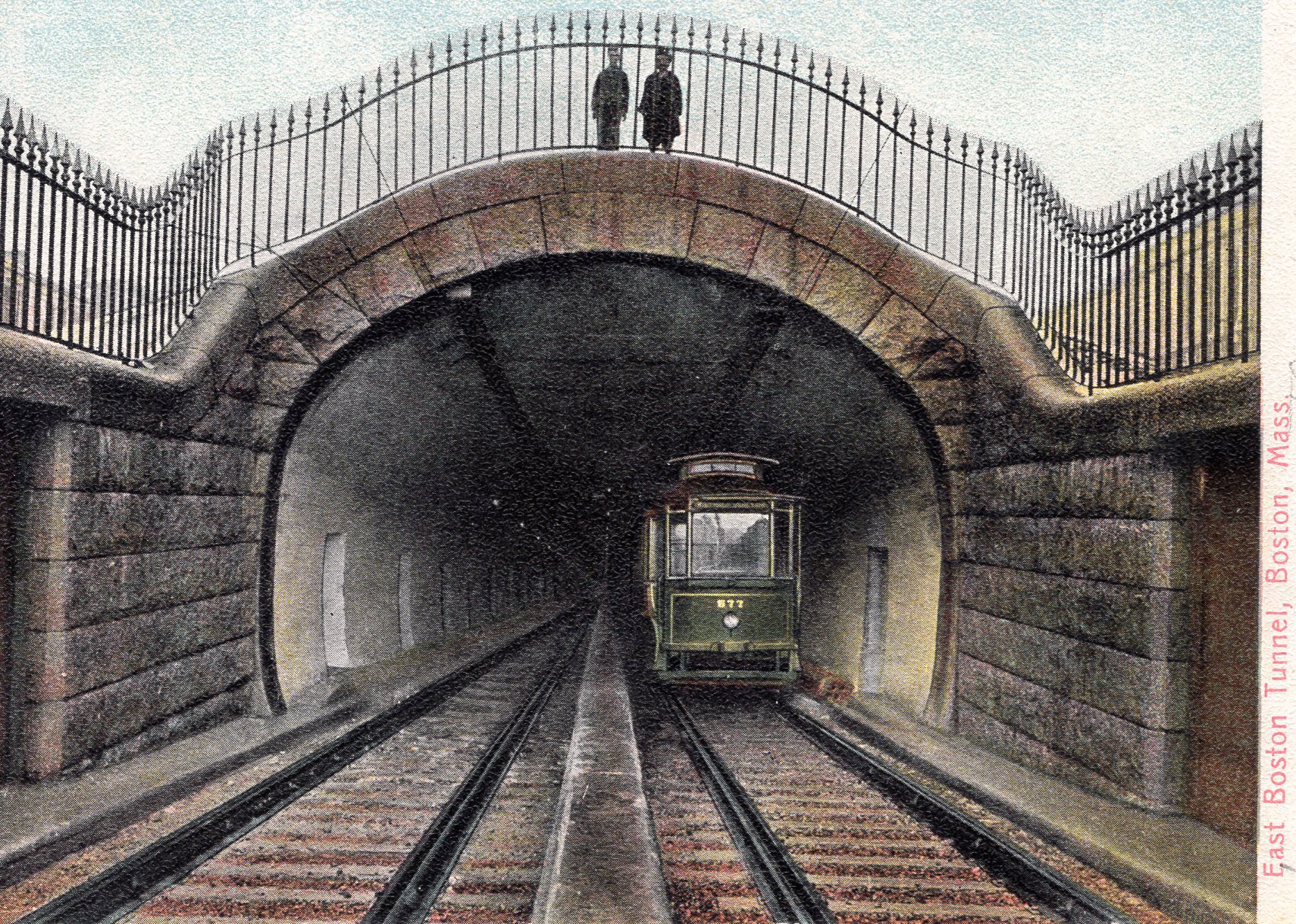
Early 1900s postcards captured the novelty of a trolley disappearing into the tunnel dug under the harbor from its portal in Maverick Square.

Sign Location

More …

“When we had a cough or some kind of a communicable disease, our parents would bundle us up and take us back and forth on the ferry. They claimed the sea air would help us.” (East Boston resident)

 “In the mid-fifties, the old ferry terminal was closed and boarded up. Of course, we street kids knew how to sneak inside and explore the old building. We used to jig for eels and herring from the dilapidated ferry pier.”  (Dr. Nicholas Dello Russo, Life on the Corner blog)


“The most technically challenging portion of the [tunnel] project was the under-harbor portion. Earth was excavated from under the protection of the roof shield. Air was maintained at a higher pressure than the outside atmosphere. The high pressure air, in combination with the protection of the massive roof shield, prevented millions of tonos of soft under-harbor clay from collapsing in on tunnel excavations. The increased pressure was maintained until the entire under-harbor portion of the tunnel was lined with reinforced concrete. Workers accessed their pressurized work area through air locks on the East Boston side of the tunnel. Horses used for moving materials in the sealed work site were stabled inside the pressurized tunnel. Feed and water was brought in and manure was brought out. Within the pressurized area, and under the protection of the roof shield, men excavated by hand.”

Source: Beaucher, Steven. Boston in Transit. p.205-206.

Community activists. Colonial law. Political will. New state regulations. The combination created the 43-mile Boston Harborwalk–a public path, stretching from Logan Airport through seven neighborhoods to the Neponset River. In 1978, the Massachusetts Office of Coastal Zone Management (CZM) sought to improve public access to the waterfront. They succeeded by integrating early Colonial laws into new state regulations.

In the decades that followed, community activists, city and state government, and developers of shoreline projects have worked together to ensure the Harborwalk is always constructed along the waterfront. Some sites also provide public amenities–bathrooms, meeting places, kayak launches,
etc. The result is a fabulous path welcoming residents and visitors to our vibrant clean harbor.

Early Colonial laws established public right of access along tidelands to protect citizens’ rights to fish, hunt, and navigate at sea and along the shorefront. These laws go back even further: They stem from Roman law, which was incorporated into English law and brought over to Massachusetts by English
settlers. Then, in the 1640s, Massachusetts Bay Colony passed laws permitting private docks in the intertidal area (between low and high tide) as long as public access was retained. Almost all of Boston’s waterfront is filled land that was once the intertidal area. This, together with the centuries-old legal right of access, served as the underpinnings for the 1978 CZM regulations.

Resources

  • Sumner, William H. History of East Boston: With Biographical Sketches of its Early Proprietors, and an Appendix. Boston: William H. Piper and Company, 1858.

Acknowledgments

  • Our gratitude to the Perkins School for the Blind and David W. Cook for their partnership in creating the audio files.
  • Thank you to Nancy Seasholes for her expertise and support.