Below the Surface
in Dorchester
(awaiting installation)

From left to right, a look at salt marsh, a seawall, and a mudflat at high tide.
Illustration by Melba Torres Sosa
Dorchester Bay contains many iconic New England marine and coastal habitats. Along its shores, you can see salt marshes, mudflats, cobble beaches, and shoreline protection structures like rocky rip rap and seawalls. These habitats provide homes for algae, plants, animals, and countless invisible marine microbes. In summer, salt marsh cordgrass forms lush stands that sway in the breeze when the tide is low. Clams and worms burrow into the muddy harbor bottom. Rockweed, with its telltale air bladders for floatation, provides hunting grounds for young fish, crabs, and lobsters. Everything is connected.
The bay is ever-changing. Around 2,000 years ago, during the millennia when the only human inhabitants in the region were Native Americans, warm-water shellfish like quahogs were gradually replaced by soft-shell clams. In the 1800s a new species appeared: Green Crabs, which prey on soft-shell clams. The Green Crabs likely hitched a ride here on ships from Europe. Currently, as the ocean warms, Blue Crabs have expanded their range north into our bay.
Look closely. As Rachel Carson said, “The edge of the sea is a strange and beautiful place.”
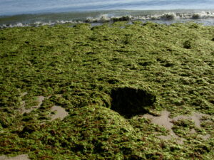
Sea lettuce creates dense beds, food for skeleton shrimp and snails. Do you see it on the mud flats in the cove?
Photo by Carol Thornber
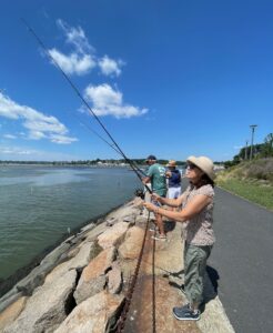
Fish, from the smallest Mummichog to the largest Striped Bass, swim throughout the bay. A vital part of the marine environment, they are also a food source for sea birds, marine mammals such as harbor seals, and, of course, humans.
Photo by Bruce Miller
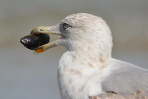
Mussels live in the nooks and crannies of rocks and cobbles in the intertidal zone. Do you see broken shells on the Harborwalk pavement where gulls have dropped clams and mussels to crack them open?
Photo by Ben Kerckx from Pixabay
Sign Location
More ...
Resources
Acknowledgments
- Friends of the Boston Harborwalk is deeply grateful to the George B. Henderson Foundation for funding the design, manufacture and installation of the signs at Columbia Point.
- Warm thanks to University of Massachusetts Boston faculty: Jarrett Byrnes, Rachel Skvirsky, and Carol Thornber as well as graduate student Melba Torres Sosa for creating the content for this sign.
- Our gratitude to the Perkins School for the Blind and Thomasine Berg for their partnership in creating the audio files.