Savin Hill Yacht Club
in Dorchester

Savin Hill Yacht Club’s clubhouse was originally nestled on the beach among the homes on Savin Hill Avenue.
1890 photo by Nathaniel L. Stebbins, courtesy of Historic New England
For more than 150 years, The Savin Hill Yacht Club has been providing recreational boaters a welcoming gateway to Boston Harbor.
The yacht club was established as the Savin Hill Beach Association in 1875 to encourage “yachting, rowing and nautical science” among the families settling into the houses then being built in the area. It became an important social center for the neighborhood.
Renamed the Savin Hill Yacht Club in 1888, it erected a new clubhouse on Savin Hill Beach in 1890. Then in 1906, to be closer to deep water, the clubhouse was rolled on logs – powered by a horse-driven winch – along the marshy shore to its present location.
Members originally came mainly from Savin Hill’s close-knit community, but the construction of the Old Colony Parkway in 1924 – widened into Morrissey Boulevard in 1951 – made the club more accessible to outsiders and brought new members from other neighborhoods. Then as now, Savin Hill Yacht Club proudly describes itself as “a working folks yacht club.”
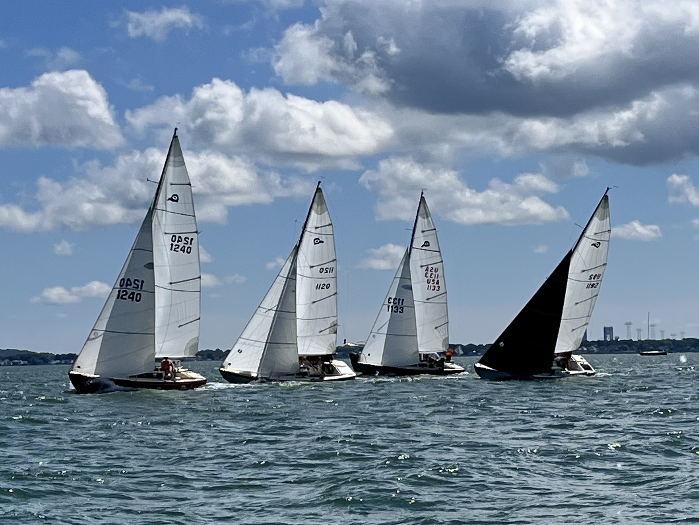
The Savin Hill Yacht Club has long sponsored regattas. An early racing rivalry sprang up with “the Harrison Square crowd,” the forerunner of today’s Dorchester Yacht Club. Since 2023, the club has hosted the Boston Harbor Ladies Challenge, the first all-women’s sailboat race in Boston Harbor seen here in a closely contested race.
Kathleen Seero, founder of the Boston Harbor Ladies Challenge
“Early in 1924, it was voted that the ladies could remain on the premises till 11 p.m., instead of 10 o’clock, during daylight saving time.” from “Savin Hill Yacht Club: A Century in Retrospect,” Dorchester Atheneum, 1975.
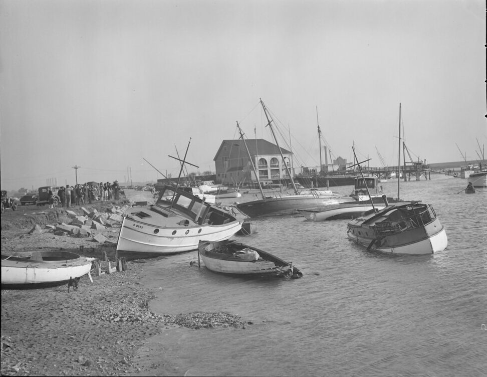
When the 1938 Hurricane slammed into Dorchester Bay, the Savin Hill Yacht Club’s landmark clubhouse survived, but many of the boats in its diverse fleet were damaged.
Courtesy of Boston Public Library, Leslie Jones Collection
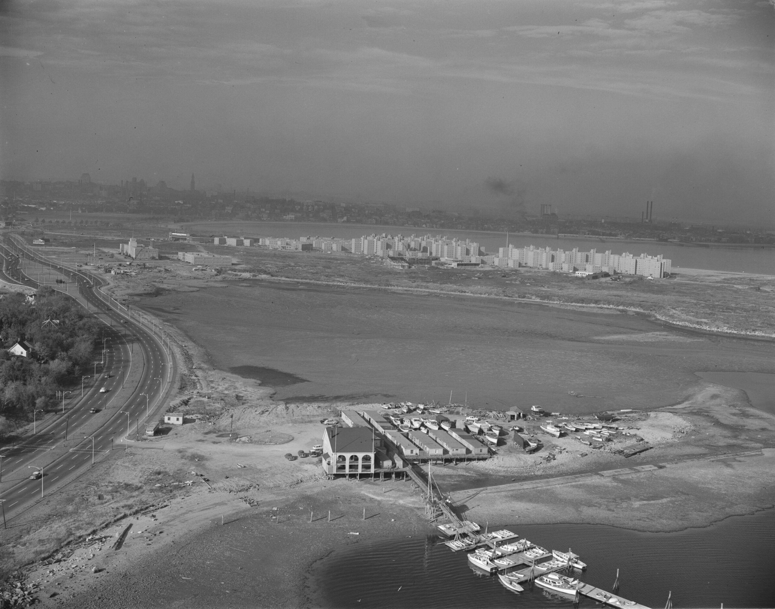
Savin Hill Yacht Club sits on Fox Point, once a fishing ground for the Massachuett tribe’s Neponset band. In this 1955 photo, the open land beyond the clubhouse marks the future site of UMass Boston.
FayFoto, Northeastern University Library
“Growing up on Savin Hill, all of us kids were down at the yacht club all summer. We loved doing chores around the clubhouse and we were always hoping somebody would take us out fishing or to one of the islands, which we knew like the backs of our hands.” Henry L. Sheehan (1920–1995)
Sign Location

More …
Resources
- “History of Savin Hill Yacht Club,” Description from National Register form for Savin Hill Historic District, 1976.
- Interviews with Savin Hill Yacht Club Historical Research Committee and Maureen Sheehan.
- “Savin Hill Yacht Club: A Century in Retrospect,” Dorchester Atheneum, 1975.
- Vrabel, Jim. When in Boston: A Time Line and Almanac, Northeastern University Press, 2004.
Acknowledgments
- Friends of the Boston Harborwalk is deeply grateful to the George B. Henderson Foundation for funding the design, manufacture and installation of the signs at Columbia Point.
- Our gratitude to the Perkins School for the Blind Recording Studio and Thomasine Berg for their partnership in creating the audio files.