Creating Our Harbor Home
in Dorchester

Described by John Smith as “a Paradise of all these parts,” Boston Harbor is a large, sheltered harbor with over 30 islands. The harbor’s diverse ecosystems have attracted abundant life to its coast, rivers, and uplands for thousands of years.
Satellite image courtesy of Wanmei Lang, NASA Earth Observatory
Boston Harbor got its start 550 million years ago in volcanic eruptions that gave rise to the sedimentary bedrock of Boston Basin and the harder igneous rock of its surrounding hills. Eons later, ice age glaciers carved out the future harbor and deposited glacial debris, chiefly as elongated hills called drumlins. As the glaciers melted, sea level rose and flooded an ancient river valley to create Boston Harbor. The drumlins became today’s harbor islands.
Hunters and gatherers arrived 12,000 years ago, before the harbor formed, following game into what was then a tundra-like landscape. People adapted as the region warmed, settling in villages along the coast and rivers.
For centuries, Columbia Point was a marshy peninsula surrounded by tidal mudflats. Indigenous people likely harvested shellfish and gathered plant material here. Later, colonists used it for grazing livestock. In the late 1800s, Bostonians began landfill projects that added acreage and elevation. Today, UMass Boston educates its students about the wonders of Boston Harbor, formed thousands of years ago by glaciers.
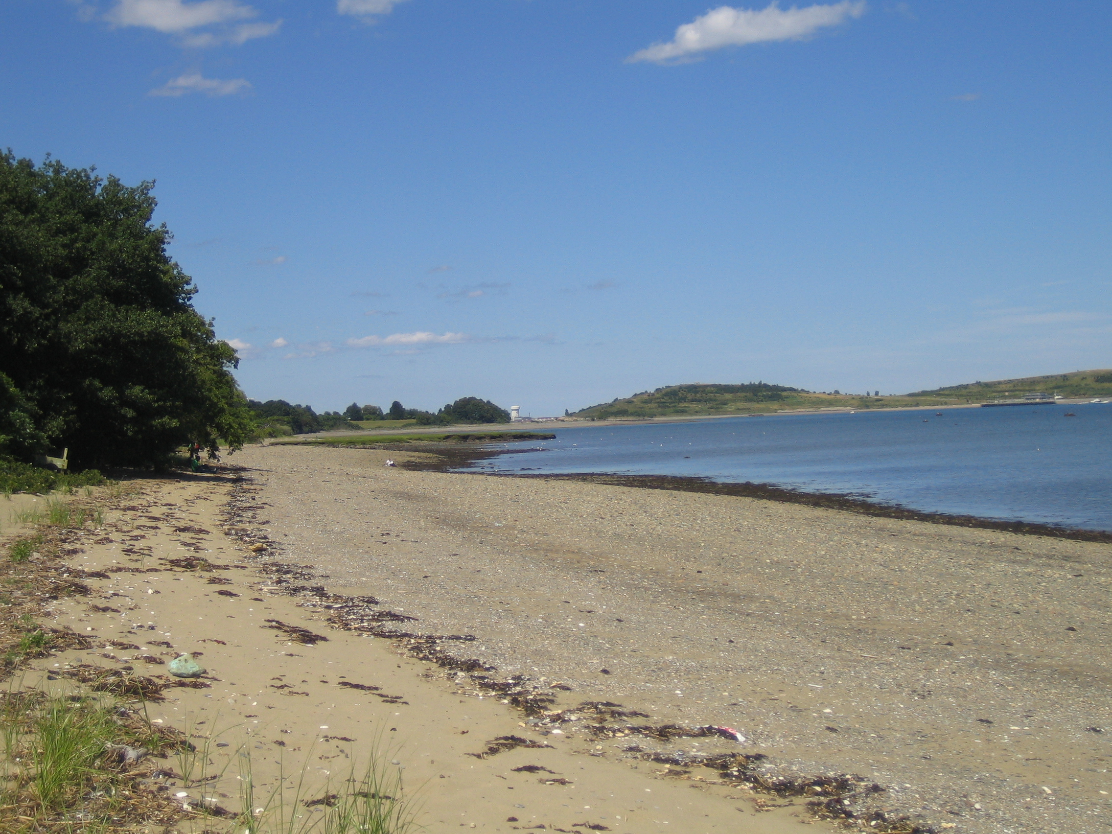
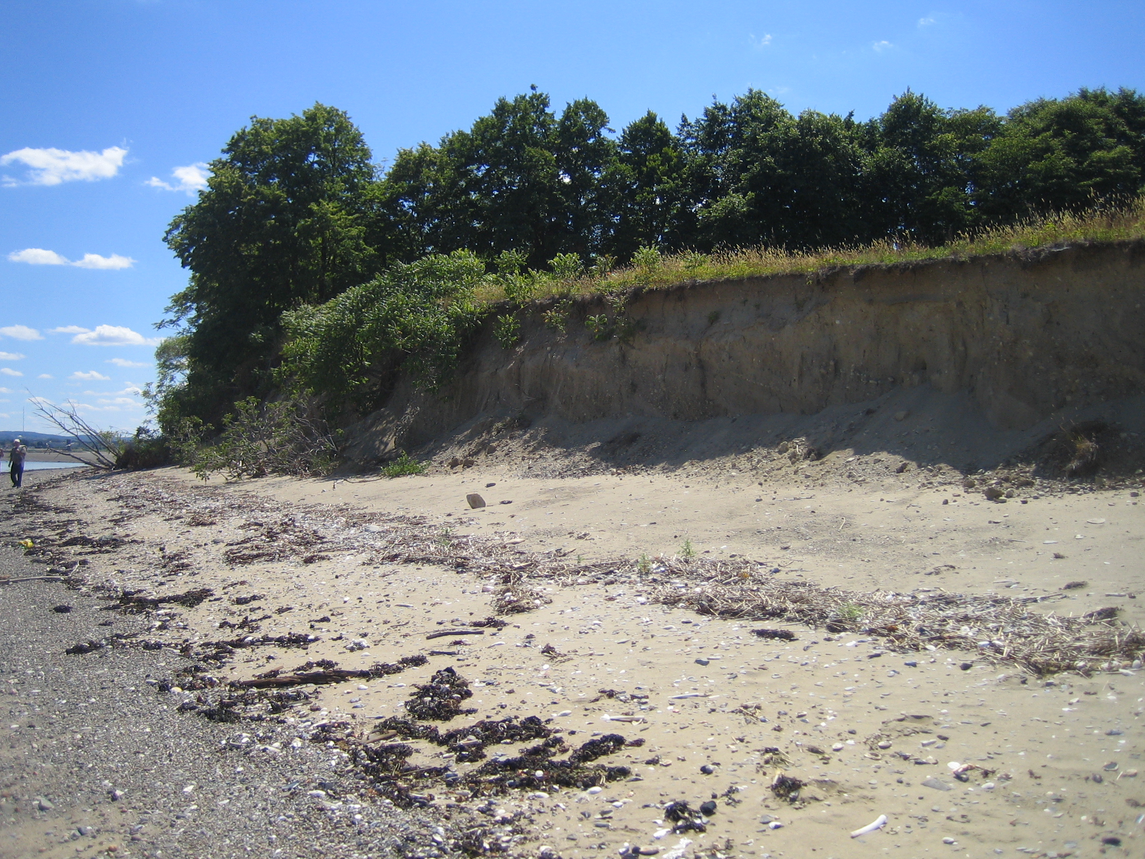
Complex processes driven by tides, waves, and wind constantly change coastal landforms such as this gravel beach and eroding bluff on Thompson Island. Sea-level rise and intensifying storm surges due to climate change amplify these processes and threaten the islands’ futures.
Courtesy of Trista L. Thornberry-Ehrlich, Colorado State University
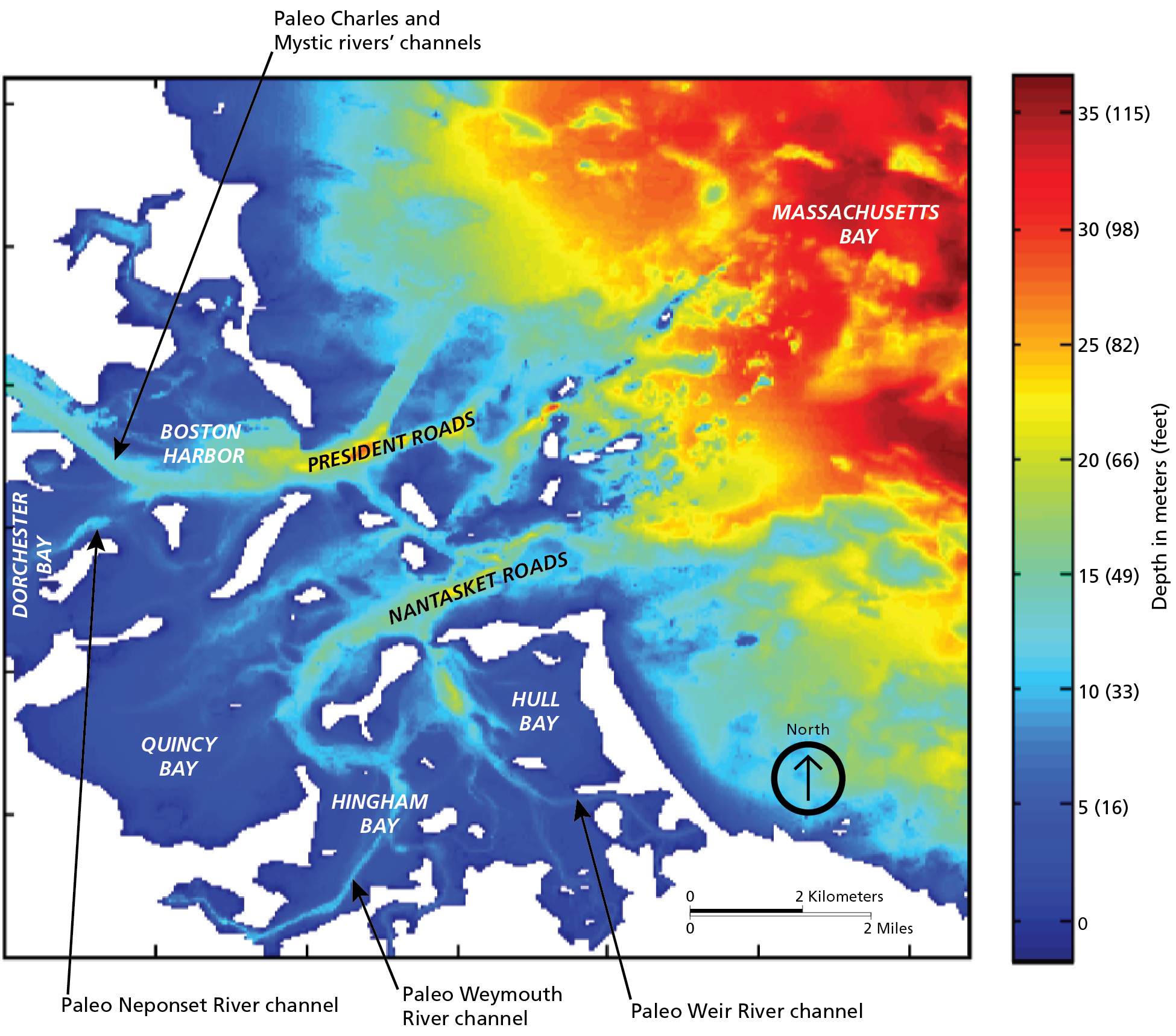
Water depth in Boston Harbor reveals ancient river channels extending east to an earlier shoreline now miles out to sea. The largest of these form today’s navigation channels. Columbia Point is off the map, west of the Paleo Neponset River channel indicated by light blue in Dorchester Bay.
Courtesy of Duncan Fitzgerald, Boston University et al.; Trista L. Thornberry-Ehrlich, Colorado State University
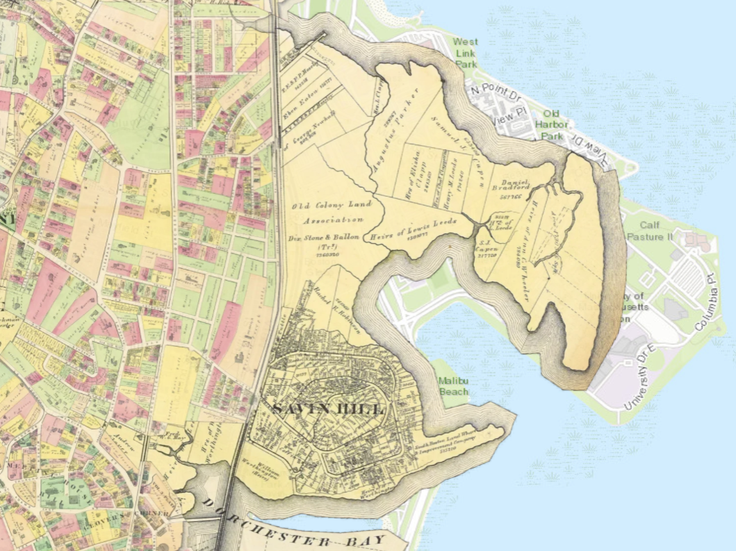
An 1874 map overlayed on a map of today’s Columbia Point shows the peninsula remained marshy and uninhabited before decades of landmaking began. In contrast, the surrounding neighborhoods were undergoing rapid development.
Courtesy of Mapjunction
Sign Location

More …
Resources
- Bagley. Joseph. A History of Boston in 50 Artifacts. University Press of New England, 2016.
- “Boston Harbor” National Park Service. https://www.nps.gov/places/boston-harbor.htm Accessed July 12, 2025.
- “Boston Harbor Islands: Geology.” National Park Service. https://www.nps.gov/boha/learn/nature/geologicformations.htm Accessed July 12, 2025.
- “Boston Harbor Islands: A National Park Area General Management Plan.” National Park Service 2002. https://www.nps.gov/boha/upload/BOHA_GMP_03-20041-508-2.pdf Accessed July 12, 2025.
- FitzGerald, D. M., Z. J. Hughes, and P. Rosen. 2011. Boat wake impacts and their role in shore erosion process, Boston Harbor Islands National Recreation Area. Natural Resource Report NPS/NERO/NRR—2011/403. National Park Service, Fort Collins, Colorado. https://npshistory.com/publications/boha/nrr-2011-403.pdf Accessed July 12, 2025.
- Hein, Christopher J. et al. Refining the model of barrier island formation along a paraglacial coast in the Gulf of Maine.
- Seasholes, Nancy S., edt. Atlas of Boston History. University of Chicago Press 2019.
- Seasholes, Nancy S. Gaining Ground: A History of Landmaking in Boston. Massachusetts Institute of Technology 2003.
- Thornberry-Ehrlich, Trista L. Boston Harbor Islands National Recreation Area Geologic Resources Inventory Report. Natural Resource Report NPS/NRSS/GRD/NRR—2017/1404. National Park Service, Fort Collins, Colorado. https://npshistory.com/publications/boha/nrr-2017-1404.pdf Accessed July 12, 2025.
- Voiland, Adam. The Drumlin Islands of Boston Harbor. NASA Earth Observatory. April 23, 2025. https://earthobservatory.nasa.gov/images/154204/the-drumlin-islands-of-boston-harbor Accessed July 12, 2025.
Acknowledgments
- Friends of the Boston Harborwalk is deeply grateful to the George B. Henderson Foundation for funding the design, manufacture and installation of the signs at Columbia Point.
- Our gratitude to the Perkins School for the Blind Recording Studio and Thomasine Berg for their partnership in creating the audio files.
- Thank you to Wanmei Liang, who graciously provided a custom version of her satellite image of Boston Harbor.