A World Class Pier
in South Boston

This postcard highlights Commonwealth Pier’s innovative features early in its operation. Freighters docked alongside a two-level shed, which trains entered via the headhouse on either side. Passenger cars approached via the viaduct above.
Courtesy of WardMaps LLC
Commonwealth Pier was the largest and best equipped passenger and cargo shipping complex on the East Coast when completed in 1914. It was part of a harbor improvement project that spanned decades and created 650 acres of piers and industrial land in South Boston.
Designed by Henry F. Keyes, the structure boasted a neoclassical headhouse with three two-story sheds stretching behind it. The pier provided deep-water berths for five vessels and facilities to handle marine, rail, and vehicular transport. The imposing arcade and triumphal arch exemplified the City Beautiful movement, which was thought to foster civic virtues.
A dedicated power station supplied heat to offices and passenger accommodations. Electricity— transformed at a pier substation— powered equipment and lit the large interior. Roofline lighting enabled ships to dock at night. Sprinklers and pumps that drew salt water from the harbor provided fire protection.
Commonwealth Pier served as an active passenger and freight terminal into the 1960s, when the pier’s use declined as its facilities became obsolete.
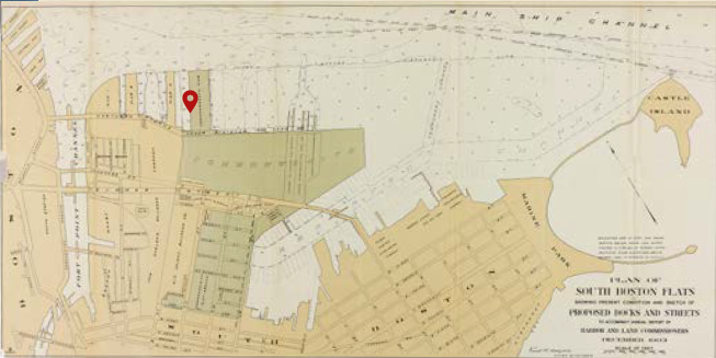
This 1903 map depicts the large expanse of recently made land in South Boston, including the 1200-foot x 400-foot Commonwealth Pier.
Courtesy of State Library of Massachusetts
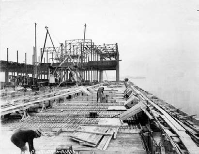
The freight shed on the pier’s east side took shape in March 1913. By May 31 the two-story shed was ready to welcome passengers to temporary facilities, while construction on the pier continued.
Courtesy of Revolutionary Spaces
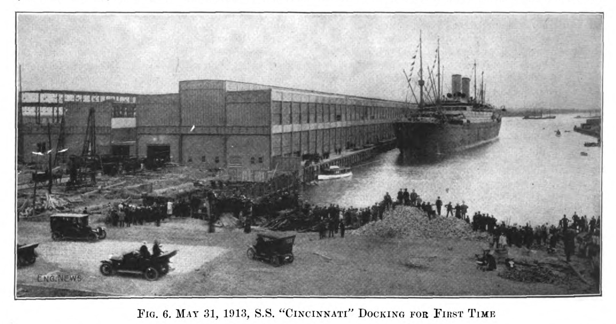
Despite Hamburg-American’s critical importance to Commonwealth Pier’s opening, its service was suspended during World War I. Cincinnati and her sister ship Amerika spent the war docked at Hamburg-American’s berths here, while the company paid dockage fees.
Engineering News, April 2, 1914
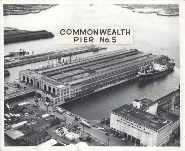
In the 1950s Commonwealth Pier still handled cargo ships and passenger liners but had to be modernized when trucking replaced railroads as the principal means of transporting cargo.
Boston Traveler, July 23, 1956, courtesy of Jan Engelman
Sign Location

More …
Resources
- Barrett, Robert E. “The Development of the Port of Boston.” Engineering News, 2 April 1914, pp. 709-717.
- The Commonwealth of Massachusetts. First Annual Report of the Port of Boston Commission. January 1955.
- Commonwealth Pier Five, Massachusetts Cultural Resource Information System Inventory Form. Massachusetts Historical Commission, 2014
- Commonwealth Pier Five, National Register of Historic Places Nomination Form. U.S. Department of Interior, 1979
- Hines, Gerald F. “Boston in War Paint.” The American Review of Reviews: An International Magazine, edited by Albert Shaw, January-June 1918.
- Seasholes, Nancy S. Gaining Ground: A History of Landmaking in Boston. The MIT Press, 2003.
- Stott, Peter. South Boston. Draft industrial archeology report on firms in South Boston. On file at Massachusetts Historical Commission.
- “What is the City Beautiful Movement?” Planetizen. https://www.planetizen.com/definition/city-beautiful last accessed 23 Apr 2023.
- Our gratitude to the Perkins School for the Blind and David W. Cook for their partnership in creating the audio files.